Search
No search results found
No search results found
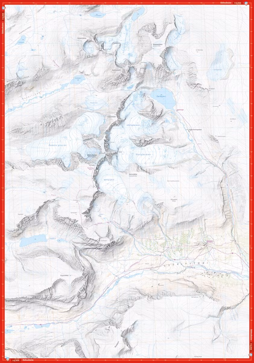
This is a unique map with a wealth of detail that has never before existed of Sweden's highest mountain. The terrain information in the map is based on airborne laser scanning. For the first time, cliffs, larger rocks, forests and streams appear with an accuracy that truly corresponds to reality. The glaciers' current extent and fracture zones have been produced in collaboration with the Department of Natural Geography at Stockholm University.
A map on a scale of 1:15,000 provides good support for those who do summit tours, glacier hikes or otherwise leave the marked trails of the valleys and try new routes at higher altitudes.